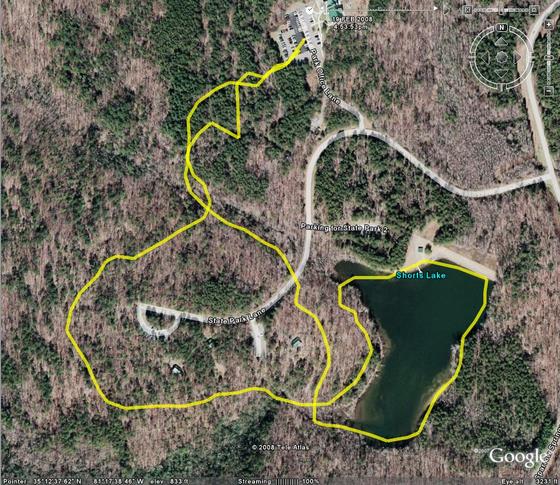
This is a sample of a tracklog being overlayed on a map, using Google Earth. This shows the best and worst of the GPS system. First of all, it provides a nice clear shape of where you travel. The trouble begins when the device records a bogus point in its log. When you see sporadic lines and lines that look like they should be the same, but aren’t, thats what has happened. In this map, the best example of this is at the top of the map where the device was on its return path to the park office parking lot. Those lines should overlap, or at least parallel, but on the reverse trip something went wrong, data bounced off of a cloud or some other interference “bounced” the signal, placing some of the trackpoints in locations where I didn’t travel.